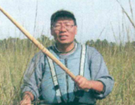
Fin Dooley

Biography
SUMMARY OF EXPERIENCE
Dr. Fugui Wang is a Senior Scientist specializing in Remote Sensing and Ecological Modeling. Fugui has over 27 years of professional experience and has worked on hundreds of projects associated with remote sensing, ecosystem modeling, statistics, and GIS. In particular, he has developed a remote sensing workflow to classify vegetation into species and species groups across landscapes; developed a statistical modeling approach by integrating remote sensing technology for estimation of vegetation biophysical characteristics (e.g. biomass) at high accuracy; integrated ecosystem modeling with remotely sensed images for more accurate wetland classification and mapping; developed a method to apply to apply radiative transfer theory and model for radiometric correction of satellite images; and worked on project models associated with multiple sciences: ecosystem ecology, forestry, agriculture, geography, water resources, wildlife, botany, soil, entomology, wetland, statistics, and land management.
The focus of the remote sensing technology Fugui applies to AES' projects is about how to process and interpret high spatial resolution (6 to 12 inches) multispectral aerial and satellite images to create products which inform decision-making for land management. In addition, he also incorporates and combines secondary datasets with optical remote sensing such as radar, Lidar, and terrestrial laser scanning to create products which are not possible on their own for AES' project scope.
Fugui is also actively involved in all phases of project management, extending from project development/proposal writing to client communication and project execution. He is a professional project manager, trained by the Project Management Institute. His aim is to meet and exceed project objectives and ensure client satisfaction by delivering the highest- quality product possible within set budget and timeline expectations.
References
SELECT PROJECT EXPERIENCE
Invasive Vegetation (e.g. Phragmites and Honeysuckle) Mapping and Management, Greater Dayton, OH, 2013; Green Bay, WI and Saginaw Bay, Ml 2013; Green Bay and Washington County, WI, 2015, 2018;
Kenosha County, WI, 2015; Niagara Gorge, NY, 2017; Jackson County, WI, 2018. Classification and mapping of invasive vegetation with high resolution images.
Aerial Monitor Reclamation, MT, 2012, 2016; Shullsburg, WI, 2014. Detection of drought stress on multiple species of grass and forbs and classifying the vegetation into species groups at reclaimed mine sites.
Open Space Lands Management, Salt Lake City, UT, 2014. Classification of herbs, shrubs, and forests at detailed species and species group levels at open spaces of Salt Lake City, UT.
Ecoservices Badger Ammo Site, Sauk County, WI, 2017. Classification and spatial-explicit estimating biomass of herbs, shrubs, and forests in a remediated army ammunition plant by fusion of multiple sources of images and ground work. Designed a plan for soil field sampling to assist with agricultural and ecological land use planning.
Wild Rice Classification, Athens, Ml, 2013 - 2014, 2018; Upper Peninsula of Ml, 2012. Classification and delineating wild rice distribution for its habitat protection and restoration.
EDUCATION
Ph.D., Forestry. Louisiana State University, Baton Rouge. 2009
M.S.. Geography, The University of Memphis, TN, 2004
M.S., Forest Resource Protection, Northwest A&F University, China, 1995
B.S., Forest Resource Protection. Northwest A&F University. China, 1992
AWARDS, GRANTS, AND HONORS
Louisiana State University. College of Agriculture: Distinguished Dissertation Award (2009)
Chinese Academy of Forestry: Researcher of the Year (1998)
Research Institute of Forest Ecology. Environment & Protection, Chinese Academy of Forestry: of the Year (1997)
First place, Joumal Paper Competition (1997)
NASAs Coastal Restoration & Emancement through Science & Technology (CREST) Program: Scholar Award (2006 2007)
Xi Sigma Pi, Nu Chapter. Forestry Honor Society (2006)
